Webb Lake Fishing Spot
- Elevation: 676'
- Last Modified By: vinny60 on 09/12/09 05:52 PM
- Ask about Webb Lake in our Fishing Forums
Photos
Fish Species
Comments
-
Fly fishermen can find a brown trout or a brook trout at the headwaters of the Webb River, or in the several streams flowing into Webb Lake
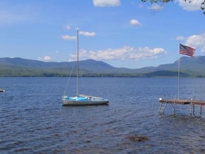
Webb Lake Description
Located less than a half day's drive from Boston and two hours from Portland, the Tumbledown region of western Maine is known for its sweeping vistas, alpine ponds, and popular hiking trails. Nestled in the heart of this scenic area lies Webb Lake, a seven-mile long expanse of clear water, sandy beaches, and wooded shores in Weld. A series of peaks—stretching from Mount Blue to Tumbledown, Jackson, and Hurricane Mountains—rings the lake and forms the threshold to this part of the great North Woods. Nearby Mount Blue State Park is the region's signature attraction, hosting more than 70,000 visitors each year. The park and surrounding Tumbledown region provide habitat for a wide variety of wildlife, including moose and black bear, endangered Peregrine falcons and bald eagles, and the rare Bicknell's thrush, which breeds only in high elevation spruce-fir forests. In addition, the roughly 8,000-acre park offers visitors an extensive network of trails, a sandy beach, and a widely used camping area. Its popularity with everyone from hikers to mountain bikers, horseback riders, and snowmobilers recently earned it a spot on Outside Magazine Family Vacation Guide's top 10 list. On Lake Webb, the earnest angler can fish for abundant perch, smallmouth bass, pickerel and sunfish. A few salmon adorn the creels of local fishermen every year. Fly fishermen can find a brown trout or a brook trout at the headwaters of the Webb River, or in the several streams flowing into Webb Lake.