Salmon Falls River Fishing Spot
- Elevation: 414'
- Last Modified By: vinny60 on 09/12/09 03:39 PM
- Ask about Salmon Falls River in our Fishing Forums
Photos
Fish Species
Comments
-
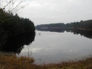
The Salmon Falls River is a tributary of the Piscataqua River in the U.S. states of Maine and New Hampshire. It rises at Great East Lake and flows south-southeast for approximately 38 miles (61 kilometers), forming the border between Maine and New Hampshire. The Salmon Falls River joins the Cochecho River near Dover, New Hampshire to form the Piscataqua River. The river provides hydroelectric power at Milton, North Rochester, Somersworth, and Rollinsford, New Hampshire, as well as Berwick and South Berwick, Maine.
Salmon Falls River Description
The Salmon Falls River is a tributary of the Piscataqua River in the U.S. states of Maine and New Hampshire. It rises at Great East Lake and flows south-southeast for approximately 38 miles (61 km), forming the border between Maine and New Hampshire[1]. The Salmon Falls River joins the Cochecho River near Dover, New Hampshire to form the Piscataqua River. The river provides hydroelectric power at Milton, North Rochester, Somersworth, and Rollinsford, New Hampshire, as well as Berwick and South Berwick, Maine. The final three miles of the river, from South Berwick to the Piscataqua, are tidal.