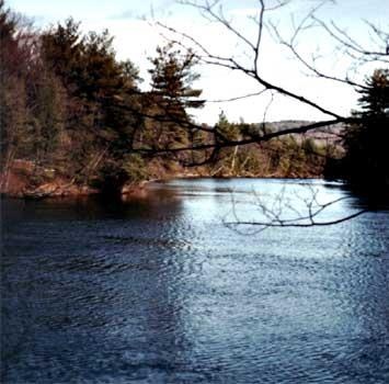
Saco River Fishing Spot
- Public Fishing: Yes
- Elevation: 383'
- Last Modified By: carpmaster on 05/14/12 10:51 PM
- Ask about Saco River in our Fishing Forums
Photos
Fish Species
Comments
-
The last five miles before the ocean, in the tidal portion below the Main Street bridge in Biddeford, are perhaps the most heavily fished of the entire 134-mile river. It is a haven for striped bass fishermen, who bring their boats in droves to the public launch sites in Biddeford and Saco.
Saco River Description
The Saco River is a river in northeastern New Hampshire and southwestern Maine in the United States. It drains a rural area of 1,703 square miles of forests and farmlands west and southwest of Portland, emptying into the Atlantic Ocean at Saco Bay, 134 miles from its source. It supplies drinking water to roughly 250,000 people in thirty-five towns. The Saco is a popular recreational river, drawing an estimated 3,000 to 7,000 people per summer weekend, mostly on the stretch from Swan's Falls (a campground maintained by the Appalachian Mountain Club) to Brownfield, Maine. There are many sand beaches along the Saco and camping is allowed along these beaches for free. Obtain permit from State of Maine for fires along the beaches.[citation needed] The Saco is a major attraction for canoeists. Several canoeing rentals are available throughout the river's distance. They come for the trout, the bass, the stripers and the shad. They come in boats, or fish from the shore wearing waders and shorts. Fishermen are everywhere on the Saco River, from the headwaters in New Hampshire to the river's mouth in Camp Ellis. The last five miles before the ocean, in the tidal portion below the Main Street bridge in Biddeford, are perhaps the most heavily fished of the entire 134-mile river. It is a haven for striped bass fishermen, who bring their boats in droves to the public launch sites in Biddeford and Saco.
Coordinates: 43°27?40?N 70°22?37?W? / ?43.46111°N 70.37694°W? / 43.46111; -70.37694