Sabattus Pond Fishing Spot
- County: Androscoggin
- Acreage: 1962
- Mean Depth: 14'
- Max Depth: 19'
- Elevation: 335'
- Website: http://www.maine.gov/ifw/fishing/lakesurvey_maps/androscoggin/sabattus_pond.pdf
- Last Modified By: shadesniper on 05/03/12 12:54 AM
- Ask about Sabattus Pond in our Fishing Forums
Photos
Fish Species
Comments
-
Sabattus Pond has taken on an ever increasing population of Northern Pike because of the shallow water and abundant food source.
Sabattus Pond Baits and Tackle
Topwater Bait Check Prices
Bass Jig Check Prices
Sabattus Pond Description
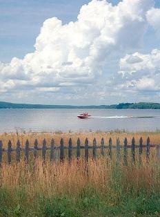
Sabattus is a small town of approximately 4,000 that has no red lights and just a few stop signs. It’s best described as a “bedroom community,” and is located in south central Maine near the towns of Lewiston and Lisbon. Sabattus Pond, which really looks more like a small lake, has over 1900 acres but only has an average depth of 14 meters. This makes it good for ice fishing, which is the main sport here, and in the wintertime, you can see virtual ice hut villages all over the lake. Sabattus also has snowshoeing, snowmobiling, cross-country skiing and downhill skiing at nearby Lost Valley Ski Resort. Summertime fishing is also excellent in Sabattus Pond because it’s not a heavily fished lake. Other outdoor sports include hiking, swimming, canoeing, water skiing and jet skiing. Sabattus Pond is also known for its’ family of loons, and its’ migratory waterfowl sightings. Folks here are friendly and you’ll find all the necessary amenities such as good restaurants, grocery stores, a local hardware store, post office, etc. For more shopping and fine dining, the town of Lewiston is a short drive away. Much of this pond's shoreline is developed with permanent and seasonal homes. Because of its proximity to two of Maine's most populous cities, Sabattus is heavily used for a variety of recreational activities. The town of Sabattus maintains a public boat launch near Martin's Point from which anglers can access the pond.
Principal fisheries: Largemouth bass, smallmouth bass, white perch, chain pickerel.
Sabattus Pond has been plagued with poor water
quality for many years. Excessive amounts of nutrients
and sediments reaching the pond from agricultural and
residential developments have significantly altered the
pond's fisheries. For example, smallmouth bass were once
abundant, but the proliferation of rooted aquatic plants
and algae has reduced the amount and quality of habitat
required by this species. Habitat conditions now are more
favorable for largemouth bass. Recognizing this,
Department biologists introduced largemouth bass to the
pond in 1964. Presently, largemouths appear to be
abundant and are providing a popular fishery,
particularly during the summer months. Only a small
fishery for smallmouths remains.
The loss of a once~abundant smelt population can
also be attributed to deteriorated water quality.
In 1981, the Maine Department of Environmental
Protection, in conjunction with federal and local
agencies, implemented a long-term water quality
restoration project. Project objectives include annual,
late-summer water level drawdowns, and controls on
certain land-use activities in the watershed. Both are
designed to gradually reduce the level of nutrients
available for algal growth in the summer months. Improved
water quality should benefit the pond's fisheries.
Sabattus Pond supports good populations of white
perch and chain pickerel. These species can provide fast
action to both ice and open water anglers. The open water
fishing season for warmwater species extends to the end
of October.
In recent years, the number of Northern Pike have increased greatly. The fishery has turned into pike territory.