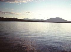
Pemadumcook Lake Fishing Spot
- Max Depth: 103'
- Elevation: 491'
- Last Modified By: vinny60 on 09/12/09 01:39 PM
- Ask about Pemadumcook Lake in our Fishing Forums
Photos
Fish Species
Comments
-
Have you fished at Pemadumcook Lake? Be the first to comment on this fishing spot.
Pemadumcook Lake Description
The Pemadumcook Chain of Lakes is the largest body of water in view as one gazes south from Katahdin. If one takes a landscape picture from that summit, these lakes span the distance from the Piscatiquis Mountains in the west to North Twin dam on Elbow Lake in the east. It is the fifth largest lake system in Maine. The Pemadumcook Chain of Lakes is 18,300 acres. The lakes are Ambajejus, Elbow, North Twin, Pemadumcook and South Twin Lake. This chain is part of the West Branch of the Penobscot River. The West Branch enters the northwest corner of Ambajejus and the current flows south through that lake. The channel passes Deep Cove on the east and Porus Isands to the west. The river channel then passes east through the east end of Pemadumcook into the head of North Twin Lake at Indian Point. The channel then follows a southeasterly course across North Twin Lake staying between Perrow Point and Spring Island and then veering eastward past Snake Point in sight of Norcross Maine. The channel then passes due east through the Elbow to North Twin dam. The length of the channel is about 11.5 miles (20 km). The combined length of the lake from the North Twin Dam following the channel in reverse to the Porus Islands and thence to the NW corner of Pemadumcook at Nahmakanta Stream is nearly 14 miles (23 km). There is a large boulder in Namakanta Stream where the Appalachian Trail appears on the south bank of the stream. It is not prudent to take a motorboat west of the boulder. The deepest parts of the lake are 103 feet (31 m), about 0.5 miles (800 m) south west of Moose Island in Pemadumcook, and 92 feet (28 m) just north of the ridge in Ambajejus Lake. There are numerous rocks in the lake and the spring runoff brings lots of logs floating about. If the water is quite high one need not concern oneself about boulders in the middle of the lake. Exceptions include but are not restricted to a large reef at the west end of South Twin Lake that runs north and south. A large rock pile 1 mile (1.6 km) NNW of Partridge Cove which is usually marked. There are a couple of reefs in North Twin and a long reef about 600 feet (180 m) north of Indian Point Island. The Porus Islands and Deep Cove have plenty of boulders. There is a surprising rock pile about 0.5 miles east of Jo Mary island. Road access to the lake is provided by Maine State Route 11 on the east side. This runs past Partridge Cove at the south east corner of South Twin Lake and then serves the area up to Norcross. Millinocket is about 5 miles (8 km) east of Norcross on Maine Route 11. The paved portion of the Millinocket–Baxter State Park road gives access to Spencer Cove at the north east end of Ambajejus Lake about 8 miles (13 km) from Millinocket. A dike at Spencer Cove created by the Great Northern Paper Company prevents water from flowing from Ambajejus Lake spillway elevation 492 feet (150 m) into adjacent Millinocket Lake, elevation 478 feet (146 m). To the north of the Chain, but not contiguous with it is Baxter State Park 209,000 acres (850 km²) and to the west are the Nahmakanta Public lands at 43,000 acres (170 km²). There is a State-sponsored boat access ramp in Partridge Cove off of Route 11. Fish include Brook Trout, Togue Lake Trout, the occasional Rainbow Trout, Atlantic Salmon (landlocked type), Whitefish, Chain Pickerel, American Eel, white perch, yellow perch, chubs, minnows, sunfishes, and hornpout (Brown bullhead).